
Our project is located in the foothills of the Cardamom Mountains, on the northern side of a small mountain belonging to the Rattan Vine Mountain Nature Reserve (ขสป.คลองเครือหวาย), in Pong Nam Ron, Chanthaburi province (also called “The Durian Province”). We live on land that formerly belonged to the indigenous Chong people, a hunter-gatherer culture belonging to the Pearic language group. Behind our garden the jungle stretches until well into Cambodia, which is about 25 km away. We’re on the northern side of a 640m-high mountain – with about 300m ASL the highest settlement around – with an amazing view.
![]()
James C. Scott (author of The Art of Not Being Governed – An Anarchist History of Upland Southeast Asia) has called the mountain range that stretches from eastern India, through Burma, Laos, and Thailand, down into Cambodia “Zomia” (meaning “highlander” in several Tibet-Burman languages; Zo = ‘remote’, ‘living in the hills’, Mi = ‘people’. Mi-zo and Zo-mi are terms used throughout Southeast Asia to designate remote hill people and the geographical niche they inhabit). We like this term, since it does not reaffirm and validate the existence of (mostly imaginary) nation-state and it describes a geographical feature, not a territory gained through conquest, genocide and war within borders that cut through ethnicities and places (as happened to the Chong).
Today, the indigenous Chong people are fully culturally assimilated into Thai society. Their lands were appropriated by agriculturalists ever since the first larger civilizations arose, notably during the Khmer Empire and, later, during the Ayutthaya period, by Tai and Thai colonizers. They were first mentioned in texts dating back to the 3rd century CE, but have probably inhabited this area for millennia.
The Chong were forced to settle down (or, if they resisted, were enslaved) first during the Kingdom of Phamniet (a small colony of ethnic Khmer in the 7th century CE), and later, after the city of Phamniet was abandoned after severe flooding in the 14th century, by Phraya Vajiraprakarn (later King Taksin the Great), who took Chanthaburi in 1767. The latter wanted to regroup his army (to liberate Siam from the Burmese), and many Chong escaped conscription by withdrawing deeper into the densely forested mountains of what is now Pong Nam Ron district – our home.
The Southeast of Thailand has everything one can desire: thick jungle, beautiful waterfalls, and majestic mountains, making it a great place to live. The climate is at least warm (if not hot) all year long (although the nights can get quite cold in January), and there is a long monsoon season, which means more rainfall than f.e. in the northeast of the country – you can grow vegetables all year long.
While officially categorized as “tropical savanna climate” or “tropical wet and dry climate” (“Aw” and “As” in the Köppen climate classification categories) because of the pronounced dry season, we are actually somewhere in the middle between Aw/As and Af (tropical rainforest climate), since all fruit that can be grown in Af climate zones can also be grown here – best example is Durian.
Our district – Pong Nam Ron – is special in this regard, because the valley acts as a channel for rain clouds, and the mountains tend to catch most lower rain clouds, so that we get a good amount of rain here and it’s never too dry.
Right in the neighboring district Soi Dao (without mountains) the climate is extremely different. There you’ll find deciduous forests that loose all leaves in dry season, allowing intense Longan and Mango cultivation, while the climate is too dry for Durian.
We are certified Elephant-Friendly!
Help Feun Foo Permaculture!

Flowers


Donate!

>99% ORGANIC CERTIFIED

Follow us on Instagram!
![[English version below]
สวนฟื้นฟูฯ ชวนชิมเมนูอาหาร 99% "ตำแมงกีนูนใส่มะม่วงดิบ" ไปด้วยกันนอีกเมนูหนึ่งที่ห้ามพลาดกันเลยเชียว! 😋
ฤดูนี้ได้ลิ้มรสอาหารอีสานจานเด็ดๆ นี้กันต่อเนื่อง เพราะเป็นฤดูแมงกีนูนแล้วช่วงนี้ พึ่งเก็บกันไปรอบแรกได้เยอะมากทีเดียว แถมยังได้กินโปรตีนคุณภาพสูงของเนื้อแมงกีนูนโดยตรงจากสวนเราเองอีกด้วย เมนูนี้ต้องขอกินกับข้าวเหนียวนึ่งร้อนๆ ถึงจะอร่อยสุดยอด😋 ซึ่งข้าวก็ได้มาจากทางบ้านที่เราไปเอาแรงช่วยกัน และแลกเปลี่ยนกับผลไม้กันทุกปี จึงขอเรียกเมนูนี้เป็นอาหาร 99 ด้วยเช่นกันน🥰
พวกเราทำเมนู "ตำแมงกีนูน" กินกันทุกปีตามฤดูกาล ออกเดินเก็บแมงกีนูนกันตามยอดไม้ทั้งจากไม้ป่าและไม้ผลตระกูลน้อยหน่า อย่าง ทุเรียนเทศ ต้นโรลินเนีย ต้นอาทีโมย่า ลำดวน อบเชยป่า ใบยอ รวมถึงใบกล้วยแมงกีนูนก็ชอบกินมากอีกด้วย และตามไม้ป่าอื่นๆ พวกเราเก็บแมงกีนูนกันสักตอนช่วงประมาณ 1-2 ทุ่ม กว่าจะเดินเก็บเสร็จก็เกือบ 3 ทุ่ม และวันหน้าค่อยได้ทำกิน ต้องให้แมงกีนูนถ่ายมูลออกค้างคืนไว้ก่อน เพื่อลดความขมของใบไม้บางชนิดที่แมงกีนูนกินไปด้วย
วันหน้าเอาแมงกีนูนไปล้างสัก 2-3 น้ำ ก็คั่วได้เลย พอคั่วสุกก็เอาปีกออกด้วย (กินง่ายกว่าและกันปีกติดคอ😅) เสร็จแล้วก็เอามาตำในครกให้ละเอียดๆ หน่อย และสับมะม่วงเปรี้ยวใส่พอเหมาะกับเนื้อแมงกีนูน ปรุงรสด้วยผักหอมหลายอย่าง สะระแหน่ พริกป่น ข้าวคั่ว น้ำปลาและน้ำปลาร้า กินเมนูนี้ด้วยกันกับพืชผักเคียงสดๆ นับสิบกว่าอย่างจากสวนกันเช่นเคย😋
รู้กันหรือไม่ว่า การกินแมลง หรือการกินเปลือกเนื้อของสัตว์ขาปล้องชนิดอื่นๆ ล้วนมีสารไคทินสูง ซึ่งช่วยขจัดไมโครพลาสติกในลำไส้ได้เยอะอีกด้วย ชวนกินแมลงที่กินได้ตามธรรมชาติมากขึ้นไปด้วยกันน๊าา🥰
Insect season has started, and the first round harvesting cockchafers yielded an abundance of high-quality insect protein straight from our garden.
After briefly boiling the bugs, we removed the wing covers and mashed them in a mortar with green mango and various spices. The result: cockchafter salad with sour mango! 😊
We eat this dish with a plethora of leafy greens from the garden.
Since we traded the rice with Karn's parents in exchange for labor & fruit, this dish is "99 percent" free as well!
(Also, did you know that eating chitin helps the body expel microplastics accumulated in the gut?)
#farmtotable #ตำแมงกีนูน #อาหารตามฤดูกาล #seasonalfood #eatzebugs](https://scontent.cdninstagram.com/v/t51.82787-15/654959199_18398882128147605_3354812573775736969_n.webp?stp=dst-jpg_e35_tt6&_nc_cat=100&ccb=7-5&_nc_sid=18de74&efg=eyJlZmdfdGFnIjoiQ0FST1VTRUxfSVRFTS5iZXN0X2ltYWdlX3VybGdlbi5DMyJ9&_nc_ohc=uu8SXl9w6pYQ7kNvwFZf7VQ&_nc_oc=AdpTN2AVsh0fJEEUwfcypVss5cAle_micitf00GUhDg_xvhUjoyinrer5drSjLZ9Li8&_nc_zt=23&_nc_ht=scontent.cdninstagram.com&edm=ANo9K5cEAAAA&_nc_gid=WADPToagmzw9CYYzWJ-RZg&_nc_tpa=Q5bMBQE3O8UkOPCfE6p4jGD00iwA9pQqbLDsM2Uybk3847n76jMumg8wKjWbVY81ZDm3aB7hdIRKLhs0&oh=00_AQDS5TKMjvqiCDgYjJcFXlvmx2t4P9_R2l79PsoCO1XK1Q&oe=6A682F7A)
![[English version below]
สวนฟื้นฟูฯ ชวนชิมเมนูอาหาร 99% "ตำแมงกีนูนใส่มะม่วงดิบ" ไปด้วยกันนอีกเมนูหนึ่งที่ห้ามพลาดกันเลยเชียว! 😋
ฤดูนี้ได้ลิ้มรสอาหารอีสานจานเด็ดๆ นี้กันต่อเนื่อง เพราะเป็นฤดูแมงกีนูนแล้วช่วงนี้ พึ่งเก็บกันไปรอบแรกได้เยอะมากทีเดียว แถมยังได้กินโปรตีนคุณภาพสูงของเนื้อแมงกีนูนโดยตรงจากสวนเราเองอีกด้วย เมนูนี้ต้องขอกินกับข้าวเหนียวนึ่งร้อนๆ ถึงจะอร่อยสุดยอด😋 ซึ่งข้าวก็ได้มาจากทางบ้านที่เราไปเอาแรงช่วยกัน และแลกเปลี่ยนกับผลไม้กันทุกปี จึงขอเรียกเมนูนี้เป็นอาหาร 99 ด้วยเช่นกันน🥰
พวกเราทำเมนู "ตำแมงกีนูน" กินกันทุกปีตามฤดูกาล ออกเดินเก็บแมงกีนูนกันตามยอดไม้ทั้งจากไม้ป่าและไม้ผลตระกูลน้อยหน่า อย่าง ทุเรียนเทศ ต้นโรลินเนีย ต้นอาทีโมย่า ลำดวน อบเชยป่า ใบยอ รวมถึงใบกล้วยแมงกีนูนก็ชอบกินมากอีกด้วย และตามไม้ป่าอื่นๆ พวกเราเก็บแมงกีนูนกันสักตอนช่วงประมาณ 1-2 ทุ่ม กว่าจะเดินเก็บเสร็จก็เกือบ 3 ทุ่ม และวันหน้าค่อยได้ทำกิน ต้องให้แมงกีนูนถ่ายมูลออกค้างคืนไว้ก่อน เพื่อลดความขมของใบไม้บางชนิดที่แมงกีนูนกินไปด้วย
วันหน้าเอาแมงกีนูนไปล้างสัก 2-3 น้ำ ก็คั่วได้เลย พอคั่วสุกก็เอาปีกออกด้วย (กินง่ายกว่าและกันปีกติดคอ😅) เสร็จแล้วก็เอามาตำในครกให้ละเอียดๆ หน่อย และสับมะม่วงเปรี้ยวใส่พอเหมาะกับเนื้อแมงกีนูน ปรุงรสด้วยผักหอมหลายอย่าง สะระแหน่ พริกป่น ข้าวคั่ว น้ำปลาและน้ำปลาร้า กินเมนูนี้ด้วยกันกับพืชผักเคียงสดๆ นับสิบกว่าอย่างจากสวนกันเช่นเคย😋
รู้กันหรือไม่ว่า การกินแมลง หรือการกินเปลือกเนื้อของสัตว์ขาปล้องชนิดอื่นๆ ล้วนมีสารไคทินสูง ซึ่งช่วยขจัดไมโครพลาสติกในลำไส้ได้เยอะอีกด้วย ชวนกินแมลงที่กินได้ตามธรรมชาติมากขึ้นไปด้วยกันน๊าา🥰
Insect season has started, and the first round harvesting cockchafers yielded an abundance of high-quality insect protein straight from our garden.
After briefly boiling the bugs, we removed the wing covers and mashed them in a mortar with green mango and various spices. The result: cockchafter salad with sour mango! 😊
We eat this dish with a plethora of leafy greens from the garden.
Since we traded the rice with Karn's parents in exchange for labor & fruit, this dish is "99 percent" free as well!
(Also, did you know that eating chitin helps the body expel microplastics accumulated in the gut?)
#farmtotable #ตำแมงกีนูน #อาหารตามฤดูกาล #seasonalfood #eatzebugs](https://scontent.cdninstagram.com/v/t51.82787-15/654964284_18398882137147605_3332198508708009435_n.webp?stp=dst-jpg_e35_tt6&_nc_cat=106&ccb=7-5&_nc_sid=18de74&efg=eyJlZmdfdGFnIjoiQ0FST1VTRUxfSVRFTS5iZXN0X2ltYWdlX3VybGdlbi5DMyJ9&_nc_ohc=akPbMQoBtIEQ7kNvwGKct_O&_nc_oc=AdrOg_owCPtGRqpFzgMuMizZR4U2piHTZ08nvMh-NHJgYaTwmTPXBLKOsXAEq1puUpc&_nc_zt=23&_nc_ht=scontent.cdninstagram.com&edm=ANo9K5cEAAAA&_nc_gid=WADPToagmzw9CYYzWJ-RZg&_nc_tpa=Q5bMBQGWAwwGfrcFm4WSuhWYYZ1M3jW_JnfN7_NiLVamlNLPGQxwf3AEbpSdSAkqXaIoA7KXr2eniSvb&oh=00_AQAIN-YMynFC5z1-x3qNw3rwjMApru9PjHr9GaQ6biExPQ&oe=6A6827D5)
![[English version below]
สวนฟื้นฟูฯ ชวนชิมเมนู "ต้มยำกระต่าย" อีกหนึ่งเมนูที่ได้จากสวนเอง 99% ช่างเกินคาดมากๆ กับรสชาติของเนื้อกระต่าย คล้ายเนื้อไก่ไม่ผิดเพี้ยนเลยก็ว่าได้ พอดีเหลือกระต่ายบ้านอยู่ตัวเดียวจึงใช้โอกาสลองทำเมนูต้มยำทั้งตัวไปเลย ต้มยำสูตรนี้เน้นใช้กระวานเป็นตัวชูรสหลักๆ เสริมรสรองด้วยเครื่องต้มยำทั่วไปอย่างตะไคร้ ข่า ใบมะกรูด แล้วก็เติมรสเปรี้ยวจี๊ดด้วยยอดอ่อนใบชะมวง😋
ตักกินกับต้มเมล็ดขนุนแทนข้าว เอร็ดอร่อยเข้ากันดีเสียจริงๆ😄😋
Another dish that's sourced 99% from our land: sour rabbit stew à la "Tom Yum" 😊
We dispatched our last "regular" rabbit today (only meat rabbits left now), and used the opportunity to make a delicious stew using the whole rabbit carcass (including head & organs). Lemongrass, galangal, kaffir lime & tomatoes gives it the typical Tom Yum flavor, plus we added cowa leaves to give it an additional refreshing sour note.
Instead of rice we eat boiled jackfruit seeds.
#feunfoosignaturedish #farmtotable #seasonalfood #localfood #creativecooking](https://scontent.cdninstagram.com/v/t51.82787-15/654029682_18398708011147605_1305124204682646531_n.webp?stp=dst-jpg_e35_tt6&_nc_cat=103&ccb=7-5&_nc_sid=18de74&efg=eyJlZmdfdGFnIjoiQ0FST1VTRUxfSVRFTS5iZXN0X2ltYWdlX3VybGdlbi5DMyJ9&_nc_ohc=d_wWfQu02TwQ7kNvwGyZXka&_nc_oc=AdqDwqLyOfBrC0wR-n9_4ifJVVFDQ798KVs_9XABIGCbGbDTq3IEMG2pwxm9Co9U2vo&_nc_zt=23&_nc_ht=scontent.cdninstagram.com&edm=ANo9K5cEAAAA&_nc_gid=WADPToagmzw9CYYzWJ-RZg&_nc_tpa=Q5bMBQHTn_WckQL5EZ6-sIkv-LxnqHb4RiYDfi_-4t4_D5srtvCRbORcERpnODpT4A8-o-F9sLGiQk1c&oh=00_AQCWC4klX4elEPGx9ydWnx4Cf-WAj58Zi6Y5n1EknesTWQ&oe=6A681FD7)
![[English version below]
สวนฟื้นฟูฯ ชวนชิมเมนู "ต้มยำกระต่าย" อีกหนึ่งเมนูที่ได้จากสวนเอง 99% ช่างเกินคาดมากๆ กับรสชาติของเนื้อกระต่าย คล้ายเนื้อไก่ไม่ผิดเพี้ยนเลยก็ว่าได้ พอดีเหลือกระต่ายบ้านอยู่ตัวเดียวจึงใช้โอกาสลองทำเมนูต้มยำทั้งตัวไปเลย ต้มยำสูตรนี้เน้นใช้กระวานเป็นตัวชูรสหลักๆ เสริมรสรองด้วยเครื่องต้มยำทั่วไปอย่างตะไคร้ ข่า ใบมะกรูด แล้วก็เติมรสเปรี้ยวจี๊ดด้วยยอดอ่อนใบชะมวง😋
ตักกินกับต้มเมล็ดขนุนแทนข้าว เอร็ดอร่อยเข้ากันดีเสียจริงๆ😄😋
Another dish that's sourced 99% from our land: sour rabbit stew à la "Tom Yum" 😊
We dispatched our last "regular" rabbit today (only meat rabbits left now), and used the opportunity to make a delicious stew using the whole rabbit carcass (including head & organs). Lemongrass, galangal, kaffir lime & tomatoes gives it the typical Tom Yum flavor, plus we added cowa leaves to give it an additional refreshing sour note.
Instead of rice we eat boiled jackfruit seeds.
#feunfoosignaturedish #farmtotable #seasonalfood #localfood #creativecooking](https://scontent.cdninstagram.com/v/t51.82787-15/654206174_18398708023147605_3336765003013670624_n.webp?stp=dst-jpg_e35_tt6&_nc_cat=109&ccb=7-5&_nc_sid=18de74&efg=eyJlZmdfdGFnIjoiQ0FST1VTRUxfSVRFTS5iZXN0X2ltYWdlX3VybGdlbi5DMyJ9&_nc_ohc=zkvuyr44C4gQ7kNvwG7c__z&_nc_oc=Adrdu4XMxUpo3U62nq_3YgrAjjb6yfBaO54V0tE0H4KqDP86CnTgrrap00ldX5TVMfY&_nc_zt=23&_nc_ht=scontent.cdninstagram.com&edm=ANo9K5cEAAAA&_nc_gid=WADPToagmzw9CYYzWJ-RZg&_nc_tpa=Q5bMBQFq3CFOjhHECigLVOvOmAUuHoOm2OPb3ssTmqWvqrFyNe9Z0cflIpx8WTDFxZTd-PiK_EXNpSGe&oh=00_AQAyROze3BAYtfcOeXU4XRpdwX21FUBjIXFb6YHlkHGBXg&oe=6A6831BB)
![[English version below]
"ผัดผักรวมใส่กุ้งฝอย" อาหาร 99% จากสวนอีกเมนูที่ขอชวนทำกินไปด้วยกันน๊าา😋 ช่วงนี้พืชผักที่สวนกำลังออกดีเกือบทุกอย่าง พอเดินเก็บผักมาผัดกินกันที ก็ได้พืชผักมาหลายอย่างมากๆ จึงทำผัดผักรวมกินซะเลย ทำเมนูนี้ต้องใส่กุ้งฝอยด้วยเพราะเป็นฤดูจับกุ้งฝอยในช่วงนี้ กุ้งฝอยในบ่อก็มีเองตามธรรมชาติอยู่แล้ว พวกเราจึงได้กินอาหารสุดแนว และอร่อยเลิศรสตามฤดูกาลกันอีกแล้ว😋 ปรุงความอร่อยด้วยการเติมกะทิสดที่เพื่อนบ้านให้มะพร้าวมาทำกินกัน เมนูนี้พวกเรากินคู่กับนึ่งหัวมันมือเสือแทนข้าวกันอีกแล้ว รสชาติดี เพิ่มรสหวานมัน จากกะทิและหัวมันนึ่งสุกๆ😋
This ultra-delicious mixed vegetable stir-fry in coconut milk is another excellent example of a "99 percent" locally sourced dish. The coconuts for the coconut milk were gifted to us by a friend, the freshwater shrimp caught by Karn in our own pond.
Instead of rice we eat steamed purple yam.
#feunfoosignaturedish #farmtotable #seasonalfood #localfood #creativecooking](https://scontent.cdninstagram.com/v/t51.82787-15/652775501_18398535892147605_8463431047421617298_n.webp?stp=dst-jpg_e35_tt6&_nc_cat=103&ccb=7-5&_nc_sid=18de74&efg=eyJlZmdfdGFnIjoiQ0FST1VTRUxfSVRFTS5iZXN0X2ltYWdlX3VybGdlbi5DMyJ9&_nc_ohc=hOa3eemcOOsQ7kNvwHt9MN-&_nc_oc=AdreLFAo4und-tMSSgu-vQ_icRh38TnPfcL8CrbwzTfCjAMG4_7ndgXqbcK3Y6BB4tI&_nc_zt=23&_nc_ht=scontent.cdninstagram.com&edm=ANo9K5cEAAAA&_nc_gid=WADPToagmzw9CYYzWJ-RZg&_nc_tpa=Q5bMBQEFIc_yd_H-S2iq6mYkoULTHiJRYELPgR1cXzG9lsZqhfMtrnYLbbvliNLhEHgO9ydSgyOCevpW&oh=00_AQB3rv6IieLfGA9TPELGQ2VpHalxIS4ZsGhSwHI92H83WQ&oe=6A68332D)
![[English version below]
"ผัดผักรวมใส่กุ้งฝอย" อาหาร 99% จากสวนอีกเมนูที่ขอชวนทำกินไปด้วยกันน๊าา😋 ช่วงนี้พืชผักที่สวนกำลังออกดีเกือบทุกอย่าง พอเดินเก็บผักมาผัดกินกันที ก็ได้พืชผักมาหลายอย่างมากๆ จึงทำผัดผักรวมกินซะเลย ทำเมนูนี้ต้องใส่กุ้งฝอยด้วยเพราะเป็นฤดูจับกุ้งฝอยในช่วงนี้ กุ้งฝอยในบ่อก็มีเองตามธรรมชาติอยู่แล้ว พวกเราจึงได้กินอาหารสุดแนว และอร่อยเลิศรสตามฤดูกาลกันอีกแล้ว😋 ปรุงความอร่อยด้วยการเติมกะทิสดที่เพื่อนบ้านให้มะพร้าวมาทำกินกัน เมนูนี้พวกเรากินคู่กับนึ่งหัวมันมือเสือแทนข้าวกันอีกแล้ว รสชาติดี เพิ่มรสหวานมัน จากกะทิและหัวมันนึ่งสุกๆ😋
This ultra-delicious mixed vegetable stir-fry in coconut milk is another excellent example of a "99 percent" locally sourced dish. The coconuts for the coconut milk were gifted to us by a friend, the freshwater shrimp caught by Karn in our own pond.
Instead of rice we eat steamed purple yam.
#feunfoosignaturedish #farmtotable #seasonalfood #localfood #creativecooking](https://scontent.cdninstagram.com/v/t51.82787-15/654027006_18398535925147605_7445549527154153661_n.webp?stp=dst-jpg_e35_tt6&_nc_cat=102&ccb=7-5&_nc_sid=18de74&efg=eyJlZmdfdGFnIjoiQ0FST1VTRUxfSVRFTS5iZXN0X2ltYWdlX3VybGdlbi5DMyJ9&_nc_ohc=8Yv5RZUAJKUQ7kNvwG5NzTG&_nc_oc=AdrlGb4jEdcDwAT4YAP4c8i_XHIJ7Qgno_om-Xa0spqe9kaVovd9CxkThfCY8Xs_tow&_nc_zt=23&_nc_ht=scontent.cdninstagram.com&edm=ANo9K5cEAAAA&_nc_gid=WADPToagmzw9CYYzWJ-RZg&_nc_tpa=Q5bMBQE2KgAg77jVSItZqH-goZfKnJ-10YqQgThIglrqeO3_S4XlcUxaJpMRwy49hghsHFdAWRbuTPVU&oh=00_AQAKylNaXs8EpaJg9yLu-hq8qblrS0pLjgS_2B7Ut0hybg&oe=6A681C0A)
![[English version below]
สวนฟื้นฟูฯ ขอนำเสนอและชวนชิมเมนูอาหาร 99 ของสวนป่าแห่งนี้ไปด้วยกันน😋
อาหาร 99 เป็นอาหารที่พวกเราตั้งชื่อขึ้นกันเองและยังเป็นเมนูขึ้นชื่อของสวนฟื้นฟูฯ เองอีกด้วย โดยอาหาร 99 เป็นเมนูที่พวกเราคิดสูตรเองและทำกินเองด้วยวัตถุดิบหลักจากสวนป่าแห่งนี้เกือบทั้งหมดเป็น 99 เปอร์เซ็นต์ ส่วนอีก 1 เปอร์เซ็นต์เป็นเพียงเครื่องปรุงรสต่างๆ น้ำมันมะพร้าวและวัตถุดิบเล็กๆ น้อยๆ ที่ยังปลูกเองไม่ได้ อย่าง กระเทียม หอมแดง หอมใหญ่นั่นเอง
เมนูนี้เรียกกันว่า ซุปมันฝรั่งปลอม😅 (Fake potato soup) เดิมที่เป็นเมนูอาหารเยอรมันที่เรียกว่า"Kartoffelsuppe" ซึ่งต้องใช้มันฝรั่งเป็นหลัก แต่พวกเราดัดแปลงสูตรด้วยการตำเมล็ดขนุนที่ต้มสุกแล้วให้ละเอียดๆ แล้วก็ใช้แทนมันฝรั่งบด และใช้กะทิแทนผลิตภัณฑ์นม ส่วนสีสันได้มาจากการตำเครื่องแกงที่เน้นขมิ้นชันและพริกไทยดำเป็นหลัก ชูรสด้วยใบมะกรูดซอย มะเขือเทศพื้นบ้าน ใบผักเหลียงและขึ้นฉ่าย เพียงแค่นี้ก็ได้กินอาหารอร่อยๆ และอิ่มท้องมากอีกด้วย (หม้อนี้กินกันเป็น 3 วันเลยทีเดียว)😄ไว้ติดตามเมนูอาหาร 99 กับอีกหลากหลายเมนูกันต่อเนื่องเร็วๆ นี้😋
This dish is loosely based on German "Kartoffelsuppe" - we call it "fake potato soup" - but uses boiled & mashed jackfruit seeds as main ingredient and coconut milk instead of dairy. The color comes from a curry paste heavy in turmeric and black pepper. Add some keffir lime leaves, melinjo, cherry tomatoes & celery - and you've got yourself a delicious - and filling! - dish.
(This pot lasted us for almost three whole days 😄)
Fake potato soup is a perfect example of "อาหาร 99," or "99-Percent-Food": a term we invented for dishes that are almost exclusively sourced from our garden (or sometimes with ingredients gifted/traded for locally). The only ingredients we buy for those dishes are garlic, onions, coconut oil and various sauces (soy sauce, oyster sauce, etc) that we can't (yet) plant or produce ourselves.
#feunfoosignaturedish #junglefood #creativecooking #permaculture](https://scontent.cdninstagram.com/v/t51.82787-15/652334922_18398407093147605_7462416825962641899_n.webp?stp=dst-jpg_e35_tt6&_nc_cat=110&ccb=7-5&_nc_sid=18de74&efg=eyJlZmdfdGFnIjoiQ0FST1VTRUxfSVRFTS5iZXN0X2ltYWdlX3VybGdlbi5DMyJ9&_nc_ohc=sNr1e0JjvuUQ7kNvwEdEFHu&_nc_oc=Ado5Aar1hiAOklk-Zt0y26iOQDUsNpR1oCnMZN2yhy2ABqbqWGByyep9C1eAFq7ewhc&_nc_zt=23&_nc_ht=scontent.cdninstagram.com&edm=ANo9K5cEAAAA&_nc_gid=WADPToagmzw9CYYzWJ-RZg&_nc_tpa=Q5bMBQHXmzZ5EAEegj7uZZC6eM3gP6NPcwdSCWL4uPAo0YKg-fipmpDoMo0Fp9WlriMzFrx3HU2KWvMQ&oh=00_AQDRKSneQiLMF31vfugP06m0HS2XfkP2qSGTOoDn0L3Mbg&oe=6A684374)
![[English version below]
สวนฟื้นฟูฯ ขอนำเสนอและชวนชิมเมนูอาหาร 99 ของสวนป่าแห่งนี้ไปด้วยกันน😋
อาหาร 99 เป็นอาหารที่พวกเราตั้งชื่อขึ้นกันเองและยังเป็นเมนูขึ้นชื่อของสวนฟื้นฟูฯ เองอีกด้วย โดยอาหาร 99 เป็นเมนูที่พวกเราคิดสูตรเองและทำกินเองด้วยวัตถุดิบหลักจากสวนป่าแห่งนี้เกือบทั้งหมดเป็น 99 เปอร์เซ็นต์ ส่วนอีก 1 เปอร์เซ็นต์เป็นเพียงเครื่องปรุงรสต่างๆ น้ำมันมะพร้าวและวัตถุดิบเล็กๆ น้อยๆ ที่ยังปลูกเองไม่ได้ อย่าง กระเทียม หอมแดง หอมใหญ่นั่นเอง
เมนูนี้เรียกกันว่า ซุปมันฝรั่งปลอม😅 (Fake potato soup) เดิมที่เป็นเมนูอาหารเยอรมันที่เรียกว่า"Kartoffelsuppe" ซึ่งต้องใช้มันฝรั่งเป็นหลัก แต่พวกเราดัดแปลงสูตรด้วยการตำเมล็ดขนุนที่ต้มสุกแล้วให้ละเอียดๆ แล้วก็ใช้แทนมันฝรั่งบด และใช้กะทิแทนผลิตภัณฑ์นม ส่วนสีสันได้มาจากการตำเครื่องแกงที่เน้นขมิ้นชันและพริกไทยดำเป็นหลัก ชูรสด้วยใบมะกรูดซอย มะเขือเทศพื้นบ้าน ใบผักเหลียงและขึ้นฉ่าย เพียงแค่นี้ก็ได้กินอาหารอร่อยๆ และอิ่มท้องมากอีกด้วย (หม้อนี้กินกันเป็น 3 วันเลยทีเดียว)😄ไว้ติดตามเมนูอาหาร 99 กับอีกหลากหลายเมนูกันต่อเนื่องเร็วๆ นี้😋
This dish is loosely based on German "Kartoffelsuppe" - we call it "fake potato soup" - but uses boiled & mashed jackfruit seeds as main ingredient and coconut milk instead of dairy. The color comes from a curry paste heavy in turmeric and black pepper. Add some keffir lime leaves, melinjo, cherry tomatoes & celery - and you've got yourself a delicious - and filling! - dish.
(This pot lasted us for almost three whole days 😄)
Fake potato soup is a perfect example of "อาหาร 99," or "99-Percent-Food": a term we invented for dishes that are almost exclusively sourced from our garden (or sometimes with ingredients gifted/traded for locally). The only ingredients we buy for those dishes are garlic, onions, coconut oil and various sauces (soy sauce, oyster sauce, etc) that we can't (yet) plant or produce ourselves.
#feunfoosignaturedish #junglefood #creativecooking #permaculture](https://scontent.cdninstagram.com/v/t51.82787-15/652156773_18398407084147605_6466634801238079112_n.webp?stp=dst-jpg_e35_tt6&_nc_cat=111&ccb=7-5&_nc_sid=18de74&efg=eyJlZmdfdGFnIjoiQ0FST1VTRUxfSVRFTS5iZXN0X2ltYWdlX3VybGdlbi5DMyJ9&_nc_ohc=dCvicUgUeTwQ7kNvwF5jxRi&_nc_oc=AdpT-pDBl7UBUW7DkO8q0_YVsppMDgUHiYJU8g3-EaIAT9rVYUL7XiKR2gdVX5Ibg4k&_nc_zt=23&_nc_ht=scontent.cdninstagram.com&edm=ANo9K5cEAAAA&_nc_gid=WADPToagmzw9CYYzWJ-RZg&_nc_tpa=Q5bMBQGDpPor-4IVlVYIWzr8Dqc68t9zWG5BhmW2Rm0P3h_gnmkhneDx_IOwdjR6tZ-JILj9Hu2fHspC&oh=00_AQBczYcDpVmhgJ53LdTgpvxNnkpSoN4zhGtW1Ga3CVwpKg&oe=6A681A30)
![[English version below]
สวนฟื้นฟูฯ ขอนำเสนอและชวนชิมเมนูอาหาร 99 ของสวนป่าแห่งนี้ไปด้วยกันน😋
อาหาร 99 เป็นอาหารที่พวกเราตั้งชื่อขึ้นกันเองและยังเป็นเมนูขึ้นชื่อของสวนฟื้นฟูฯ เองอีกด้วย โดยอาหาร 99 เป็นเมนูที่พวกเราคิดสูตรเองและทำกินเองด้วยวัตถุดิบหลักจากสวนป่าแห่งนี้เกือบทั้งหมดเป็น 99 เปอร์เซ็นต์ ส่วนอีก 1 เปอร์เซ็นต์เป็นเพียงเครื่องปรุงรสต่างๆ น้ำมันมะพร้าวและวัตถุดิบเล็กๆ น้อยๆ ที่ยังปลูกเองไม่ได้ อย่าง กระเทียม หอมแดง หอมใหญ่นั่นเอง
เมนูนี้เรียกกันว่า ซุปมันฝรั่งปลอม😅 (Fake potato soup) เดิมที่เป็นเมนูอาหารเยอรมันที่เรียกว่า"Kartoffelsuppe" ซึ่งต้องใช้มันฝรั่งเป็นหลัก แต่พวกเราดัดแปลงสูตรด้วยการตำเมล็ดขนุนที่ต้มสุกแล้วให้ละเอียดๆ แล้วก็ใช้แทนมันฝรั่งบด และใช้กะทิแทนผลิตภัณฑ์นม ส่วนสีสันได้มาจากการตำเครื่องแกงที่เน้นขมิ้นชันและพริกไทยดำเป็นหลัก ชูรสด้วยใบมะกรูดซอย มะเขือเทศพื้นบ้าน ใบผักเหลียงและขึ้นฉ่าย เพียงแค่นี้ก็ได้กินอาหารอร่อยๆ และอิ่มท้องมากอีกด้วย (หม้อนี้กินกันเป็น 3 วันเลยทีเดียว)😄ไว้ติดตามเมนูอาหาร 99 กับอีกหลากหลายเมนูกันต่อเนื่องเร็วๆ นี้😋
This dish is loosely based on German "Kartoffelsuppe" - we call it "fake potato soup" - but uses boiled & mashed jackfruit seeds as main ingredient and coconut milk instead of dairy. The color comes from a curry paste heavy in turmeric and black pepper. Add some keffir lime leaves, melinjo, cherry tomatoes & celery - and you've got yourself a delicious - and filling! - dish.
(This pot lasted us for almost three whole days 😄)
Fake potato soup is a perfect example of "อาหาร 99," or "99-Percent-Food": a term we invented for dishes that are almost exclusively sourced from our garden (or sometimes with ingredients gifted/traded for locally). The only ingredients we buy for those dishes are garlic, onions, coconut oil and various sauces (soy sauce, oyster sauce, etc) that we can't (yet) plant or produce ourselves.
#feunfoosignaturedish #junglefood #creativecooking #permaculture](https://scontent.cdninstagram.com/v/t51.82787-15/652504009_18398407102147605_7304909896739765436_n.webp?stp=dst-jpg_e35_tt6&_nc_cat=111&ccb=7-5&_nc_sid=18de74&efg=eyJlZmdfdGFnIjoiQ0FST1VTRUxfSVRFTS5iZXN0X2ltYWdlX3VybGdlbi5DMyJ9&_nc_ohc=Mu59bWXJX8gQ7kNvwHQ5Tu4&_nc_oc=AdqfaFGlPGhkeATQbfVUBa1-bAGc2h0vu_Mvo4iSNCwb2-pIPQJQVGvxv-3W2rOpTqo&_nc_zt=23&_nc_ht=scontent.cdninstagram.com&edm=ANo9K5cEAAAA&_nc_gid=WADPToagmzw9CYYzWJ-RZg&_nc_tpa=Q5bMBQHu8Xbz5jAzldLec4VM7wzSUaHgq8paXDYbP7tSpDEE0dmGOQfeMQG00LfX-nhU286DGUJk8Aaf&oh=00_AQAhbmo4O6vAcPOqo_3tE5q0LlBuCcjkkd8eT7JwAYHPhw&oe=6A683801)
![[English version below]
มาแล้วฤดูขนุนปีนี้ มาทั้งขนุนพันธุ์ทั่วไปและขนุนเปียก และอีกไม่กี่เดือนข้างหน้าขนุนจำปาดะก็จะมาด้วยเช่นกันน! 😋
สวนฟื้นฟูฯ พวกเราต้มเมล็ดขนุนกินเป็นอาหารหลักตามฤดูกาลกันตลอดเลย กินต้มเมล็ดขนุนแทนข้าวกันมาเป็นอาทิตย์แล้วด้วย แถมได้กินเนื้อขนุนสุกฉ่ำๆ หอมหวานอร่อยหลากรสกันเป็นประจำช่วงนี้ รอบนี้เป็นขนุนเปียก มีเมล็ดเยอะมากๆ พอแยกเนื้อและเมล็ดเสร็จแล้วได้เมล็ดเป็น 1 กิโลครึ่งต่อลูกเลยทีเดียว และยังได้น้ำขนุนเป็นสองกล่องอีกด้วย น้ำขนุนเปียกที่คั้นเสร็จนี้ พวกเราใช้ทำไอศกรีมกันอีกต่อหนึ่ง แค่ผสมกะทิสดเท่านั้น รสหอมมันอร่อยแถมรสเปี้ยวหวานกลมกล่อมลงตัวมากๆ😋 รอบแรกนี้ทำกินหมดไปแล้ว และยังมีอีกหลายลูกที่เหลืออยู่บนต้นรอพวกเราอยู่😅
Artocarpus seeds are seasonally our main staple - for the past week we've been eating exclusively jackfruit seeds instead of rice. The "wet jackfruit" cultivar is especially productive in terms of seeds, yielding an average of 1.5kg seeds per fruit. We just finished eating the first round (two fruit ripened simultaneously), when two more turned ripe - turning our kitchen table into a temporary jackfruit processing factory.
A positive side effect is that the byproduct of the process - thick jackfruit pulp juice - is an excellent ingredient for homemade ice cream when paired with fresh coconut milk ! 😁
#อาหารหลักตามดูกาล #ผลไม้ตามฤดูกาล #ชวนปลูกขนุน #เสริมความมั่นคงทางอาหารในครัวเรือน #staplefood](https://scontent.cdninstagram.com/v/t51.82787-15/651320098_18398169958147605_9166802174431183723_n.webp?stp=dst-jpg_e35_tt6&_nc_cat=103&ccb=7-5&_nc_sid=18de74&efg=eyJlZmdfdGFnIjoiQ0FST1VTRUxfSVRFTS5iZXN0X2ltYWdlX3VybGdlbi5DMyJ9&_nc_ohc=MrsOrUTvqb4Q7kNvwHKAR8m&_nc_oc=AdqLZbNLcHuwC7JV8BXvFHSGxPsLi05vxcnfJdUj3UGR2-CAT-L_KpIAVTLDE286X5g&_nc_zt=23&_nc_ht=scontent.cdninstagram.com&edm=ANo9K5cEAAAA&_nc_gid=WADPToagmzw9CYYzWJ-RZg&_nc_tpa=Q5bMBQHPdpHCbxqies0Gblmbr1785Sah3EH85C1VLb4-NTkOri4-E1FA-wW6u2GI01aJ3h-LnIb15iEk&oh=00_AQA6jjLpE6DxXP99dsSDc5GVVmbt6X7FvFN6URlmF2ubtw&oe=6A682B0A)
![[English version below]
มาแล้วฤดูขนุนปีนี้ มาทั้งขนุนพันธุ์ทั่วไปและขนุนเปียก และอีกไม่กี่เดือนข้างหน้าขนุนจำปาดะก็จะมาด้วยเช่นกันน! 😋
สวนฟื้นฟูฯ พวกเราต้มเมล็ดขนุนกินเป็นอาหารหลักตามฤดูกาลกันตลอดเลย กินต้มเมล็ดขนุนแทนข้าวกันมาเป็นอาทิตย์แล้วด้วย แถมได้กินเนื้อขนุนสุกฉ่ำๆ หอมหวานอร่อยหลากรสกันเป็นประจำช่วงนี้ รอบนี้เป็นขนุนเปียก มีเมล็ดเยอะมากๆ พอแยกเนื้อและเมล็ดเสร็จแล้วได้เมล็ดเป็น 1 กิโลครึ่งต่อลูกเลยทีเดียว และยังได้น้ำขนุนเป็นสองกล่องอีกด้วย น้ำขนุนเปียกที่คั้นเสร็จนี้ พวกเราใช้ทำไอศกรีมกันอีกต่อหนึ่ง แค่ผสมกะทิสดเท่านั้น รสหอมมันอร่อยแถมรสเปี้ยวหวานกลมกล่อมลงตัวมากๆ😋 รอบแรกนี้ทำกินหมดไปแล้ว และยังมีอีกหลายลูกที่เหลืออยู่บนต้นรอพวกเราอยู่😅
Artocarpus seeds are seasonally our main staple - for the past week we've been eating exclusively jackfruit seeds instead of rice. The "wet jackfruit" cultivar is especially productive in terms of seeds, yielding an average of 1.5kg seeds per fruit. We just finished eating the first round (two fruit ripened simultaneously), when two more turned ripe - turning our kitchen table into a temporary jackfruit processing factory.
A positive side effect is that the byproduct of the process - thick jackfruit pulp juice - is an excellent ingredient for homemade ice cream when paired with fresh coconut milk ! 😁
#อาหารหลักตามดูกาล #ผลไม้ตามฤดูกาล #ชวนปลูกขนุน #เสริมความมั่นคงทางอาหารในครัวเรือน #staplefood](https://scontent.cdninstagram.com/v/t51.82787-15/652252617_18398169967147605_2183191723335058176_n.webp?stp=dst-jpg_e35_tt6&_nc_cat=107&ccb=7-5&_nc_sid=18de74&efg=eyJlZmdfdGFnIjoiQ0FST1VTRUxfSVRFTS5iZXN0X2ltYWdlX3VybGdlbi5DMyJ9&_nc_ohc=g3gIF5L-oLwQ7kNvwElTPRP&_nc_oc=AdrN3V_ER1pTHVzNCEcW8uXKVpqX27NRYffsPJ9iq6OUY3WZxSHJYI_wkqGtQyEARNM&_nc_zt=23&_nc_ht=scontent.cdninstagram.com&edm=ANo9K5cEAAAA&_nc_gid=WADPToagmzw9CYYzWJ-RZg&_nc_tpa=Q5bMBQHo9FBmSqohpK7jz5ehbQXbqb_FYDVB2eCSu0d_HdR1Vcw_wISVO8b4J4tEilufwvk4QwprcUCP&oh=00_AQBnoCdRF-EGSPVH4lvD88_iaR0qTyDEuzyTQYIl9e9bdA&oe=6A683E49)
![[English version below]
มาแล้วฤดูขนุนปีนี้ มาทั้งขนุนพันธุ์ทั่วไปและขนุนเปียก และอีกไม่กี่เดือนข้างหน้าขนุนจำปาดะก็จะมาด้วยเช่นกันน! 😋
สวนฟื้นฟูฯ พวกเราต้มเมล็ดขนุนกินเป็นอาหารหลักตามฤดูกาลกันตลอดเลย กินต้มเมล็ดขนุนแทนข้าวกันมาเป็นอาทิตย์แล้วด้วย แถมได้กินเนื้อขนุนสุกฉ่ำๆ หอมหวานอร่อยหลากรสกันเป็นประจำช่วงนี้ รอบนี้เป็นขนุนเปียก มีเมล็ดเยอะมากๆ พอแยกเนื้อและเมล็ดเสร็จแล้วได้เมล็ดเป็น 1 กิโลครึ่งต่อลูกเลยทีเดียว และยังได้น้ำขนุนเป็นสองกล่องอีกด้วย น้ำขนุนเปียกที่คั้นเสร็จนี้ พวกเราใช้ทำไอศกรีมกันอีกต่อหนึ่ง แค่ผสมกะทิสดเท่านั้น รสหอมมันอร่อยแถมรสเปี้ยวหวานกลมกล่อมลงตัวมากๆ😋 รอบแรกนี้ทำกินหมดไปแล้ว และยังมีอีกหลายลูกที่เหลืออยู่บนต้นรอพวกเราอยู่😅
Artocarpus seeds are seasonally our main staple - for the past week we've been eating exclusively jackfruit seeds instead of rice. The "wet jackfruit" cultivar is especially productive in terms of seeds, yielding an average of 1.5kg seeds per fruit. We just finished eating the first round (two fruit ripened simultaneously), when two more turned ripe - turning our kitchen table into a temporary jackfruit processing factory.
A positive side effect is that the byproduct of the process - thick jackfruit pulp juice - is an excellent ingredient for homemade ice cream when paired with fresh coconut milk ! 😁
#อาหารหลักตามดูกาล #ผลไม้ตามฤดูกาล #ชวนปลูกขนุน #เสริมความมั่นคงทางอาหารในครัวเรือน #staplefood](https://scontent.cdninstagram.com/v/t51.82787-15/651437478_18398169976147605_6416522121776584666_n.webp?stp=dst-jpg_e35_tt6&_nc_cat=103&ccb=7-5&_nc_sid=18de74&efg=eyJlZmdfdGFnIjoiQ0FST1VTRUxfSVRFTS5iZXN0X2ltYWdlX3VybGdlbi5DMyJ9&_nc_ohc=RF2dD3HQbIEQ7kNvwG1WCMJ&_nc_oc=AdqixnJkUQSx5UoxNles0xU7zupx09dBFqfD7U850Q1JAWnlEAvSZRl5gGMfac37Q2k&_nc_zt=23&_nc_ht=scontent.cdninstagram.com&edm=ANo9K5cEAAAA&_nc_gid=WADPToagmzw9CYYzWJ-RZg&_nc_tpa=Q5bMBQHVyPH88SIqWF58bmqfK9xW78Z0e5ailoJOy7E19EG0mtfZnwgBQFQyGxML6rNayDyawprLUQ1f&oh=00_AQCgMsaSpJLQmdhEW3q82bPlriiEUcu-EthCOLzcI6Bm3A&oe=6A683C35)
![[English version in comments]
ในที่สุดก็ได้เก็บพันธุ์มันพื้นบ้านที่ทยอยปลูกกันไว้เรื่อยๆ ทุกปีแล้วน๊าา😋
ปีนี้พันธุ์หัวมันที่ได้เก็บเยอะสุดคือมันมอเสือ ได้ทั้งหัวใหญ่ที่อยู่ในดิน และหัวเล็กที่ออกตามเถา ได้กินอิ่มหนำสำราญกันมากๆ ช่วงนี้ ขุดมาหัวหนึ่งได้กินเป็นเกือบทั้งอาทิตย์เลยทีเดียว หัวใหญ่ๆ แบบนี้มีอายุเพียง 1 ปีเท่านั้น (ซึ่งหัวจะใหญ่กว่านี้ได้อีกถ้าอายุหลายปีกว่านี้) เนื่องจากพวกเราเตรียมพร้อมรับมือกับวิกฤติอาหารหลัก อย่าง ข้าว มานานมากแล้ว ในที่สุดก็เริ่มเห็นผลลัพธ์และได้เริ่มเก็บเกี่ยวหัวเผือกหัวมันกันมากขึ้นในปีนี้🥰
พื้นที่ไร่สวนของพวกเราปลูกข้าวไม่ได้ จึงต้องเน้นปลูกหัวเผือกหัวมันแทน ซึ่งงานปลูก งานดูแล และงานเก็บเกี่ยวนั้นน้อยมากๆ เมื่อเทียบกับการปลูกข้าว คือเราไม่ต้องเก็บเกี่ยวมาเก็บไว้ แต่เราปล่อยไว้ในดินนั่นแหละ หิวตอนไหนก็ค่อยไปขุดมากินกัน ขุดหลุมปลูกปีละครั้ง และปลูกต่อไว้ทุกครั้งที่ขุดขึ้นมากิน เพื่อว่าทุกๆ ปีและตลอดทั้งปี เราจะมีหัวเผือกหัวมันไว้กินเพียงพอในครัวเรือน ถ้าคนในบ้านเยอะหน่อยก็ต้องปลูกเยอะขึ้นตามไปด้วย เช่นเดียวกันกับหัวเผือกที่กว่าจะปลูกได้นั้น พวกเราลองปลูกเผือกมาหลายครั้งและหลายชนิด แต่ไม่มีชนิดไหนที่โตดีและโตง่ายเท่ากับเผือกหอมชนิดนี้เลย โชคดีมากที่ได้เจอพันธุ์เผือกที่โตได้ดีที่สุดในพื้นที่ของเรา ปีนี้เลยปลูกหัวเผือกเพิ่มกันอีกเยอะเลย😋
ชนิดพันธุ์ของหัวมันพื้นบ้านและหัวมันป่าที่พวกเราปลูกกันไว้ อย่าง มันมือเสือ มันพร้าว มันเหน็บ มันอ้อน มันสาคูแดง มันสาคูขาว มาห้านาที มันนก มันน้ำ มันฮืบ กลอย และเผือกหอม ที่เริ่มเห็นผลและได้เก็บเยอะสุดเห็นจะเป็นมันมือเสือ มันพร้าว และเผือกหอมเขมร (พวกเราได้พันธุ์เผือกมาจากบ้านเพื่อนบ้าน คุณป้าเอกับลุงกำพล บ้านทุ่งม่วง และลุงกับป้าก็ได้พันธุ์มาปลูกจากทางโน้นจึงเรียกกันแบบนี้) ส่วนหัวมันอื่นๆ ก็ได้กินเหมือนกันแต่ยังไม่สมบูรณ์เท่าสองสามชนิดนี้ คงแล้วแต่ช่วงปีและอายุของหัวมันแต่ละอย่าง บางชนิด อย่าง หัวมันป่าต่างๆ ยังต้องใช้เวลาอีกหน่อยกว่าจะสมบูรณ์เท่าเพื่อน แต่ถ้าปีไหนได้เก็บอะไรเยอะกว่า พวกเราก็จะเก็บชนิดนั้นไว้กินและปลูกต่อกันอีกเยอะเลย ปีนี้ปลูกมันมือเสือและมันพร้าวรวมกันกว่า 100 หลุมแล้ว และปลูกหัวเผือกเป็น 250 หลุมแล้ว โดยตั้งเป้าไว้ที่ อย่างน้อยๆ ก็ต้องปลูกให้พอสำหรับเราขุดกินได้วันละต้นทั้งปี
[อ่านต่อในคอมเมนต์]](https://scontent.cdninstagram.com/v/t51.82787-15/651175753_18397864150147605_1593198986547309812_n.webp?stp=dst-jpg_e35_tt6&_nc_cat=109&ccb=7-5&_nc_sid=18de74&efg=eyJlZmdfdGFnIjoiQ0FST1VTRUxfSVRFTS5iZXN0X2ltYWdlX3VybGdlbi5DMyJ9&_nc_ohc=HTB_zO8E5VUQ7kNvwGwP0DH&_nc_oc=AdplzNTf64k9x-jb7_QHGXKm6T_-GXixCBUZyCit-eP9WuJNxzq2MPDt7J8vXcQ3LX4&_nc_zt=23&_nc_ht=scontent.cdninstagram.com&edm=ANo9K5cEAAAA&_nc_gid=WADPToagmzw9CYYzWJ-RZg&_nc_tpa=Q5bMBQHxUsHeSi5JxuxqG0Vcd7B-MfKexB7YHsN9jitkPjeNWbbxQMU48jY_VIceCkFSaN1EMxMpCGKG&oh=00_AQBRrPkFp1gnJ1oKQeyPCkdzix6ztXcc2w6-1qmkEdH_3w&oe=6A6833A5)
![[English version in comments]
ในที่สุดก็ได้เก็บพันธุ์มันพื้นบ้านที่ทยอยปลูกกันไว้เรื่อยๆ ทุกปีแล้วน๊าา😋
ปีนี้พันธุ์หัวมันที่ได้เก็บเยอะสุดคือมันมอเสือ ได้ทั้งหัวใหญ่ที่อยู่ในดิน และหัวเล็กที่ออกตามเถา ได้กินอิ่มหนำสำราญกันมากๆ ช่วงนี้ ขุดมาหัวหนึ่งได้กินเป็นเกือบทั้งอาทิตย์เลยทีเดียว หัวใหญ่ๆ แบบนี้มีอายุเพียง 1 ปีเท่านั้น (ซึ่งหัวจะใหญ่กว่านี้ได้อีกถ้าอายุหลายปีกว่านี้) เนื่องจากพวกเราเตรียมพร้อมรับมือกับวิกฤติอาหารหลัก อย่าง ข้าว มานานมากแล้ว ในที่สุดก็เริ่มเห็นผลลัพธ์และได้เริ่มเก็บเกี่ยวหัวเผือกหัวมันกันมากขึ้นในปีนี้🥰
พื้นที่ไร่สวนของพวกเราปลูกข้าวไม่ได้ จึงต้องเน้นปลูกหัวเผือกหัวมันแทน ซึ่งงานปลูก งานดูแล และงานเก็บเกี่ยวนั้นน้อยมากๆ เมื่อเทียบกับการปลูกข้าว คือเราไม่ต้องเก็บเกี่ยวมาเก็บไว้ แต่เราปล่อยไว้ในดินนั่นแหละ หิวตอนไหนก็ค่อยไปขุดมากินกัน ขุดหลุมปลูกปีละครั้ง และปลูกต่อไว้ทุกครั้งที่ขุดขึ้นมากิน เพื่อว่าทุกๆ ปีและตลอดทั้งปี เราจะมีหัวเผือกหัวมันไว้กินเพียงพอในครัวเรือน ถ้าคนในบ้านเยอะหน่อยก็ต้องปลูกเยอะขึ้นตามไปด้วย เช่นเดียวกันกับหัวเผือกที่กว่าจะปลูกได้นั้น พวกเราลองปลูกเผือกมาหลายครั้งและหลายชนิด แต่ไม่มีชนิดไหนที่โตดีและโตง่ายเท่ากับเผือกหอมชนิดนี้เลย โชคดีมากที่ได้เจอพันธุ์เผือกที่โตได้ดีที่สุดในพื้นที่ของเรา ปีนี้เลยปลูกหัวเผือกเพิ่มกันอีกเยอะเลย😋
ชนิดพันธุ์ของหัวมันพื้นบ้านและหัวมันป่าที่พวกเราปลูกกันไว้ อย่าง มันมือเสือ มันพร้าว มันเหน็บ มันอ้อน มันสาคูแดง มันสาคูขาว มาห้านาที มันนก มันน้ำ มันฮืบ กลอย และเผือกหอม ที่เริ่มเห็นผลและได้เก็บเยอะสุดเห็นจะเป็นมันมือเสือ มันพร้าว และเผือกหอมเขมร (พวกเราได้พันธุ์เผือกมาจากบ้านเพื่อนบ้าน คุณป้าเอกับลุงกำพล บ้านทุ่งม่วง และลุงกับป้าก็ได้พันธุ์มาปลูกจากทางโน้นจึงเรียกกันแบบนี้) ส่วนหัวมันอื่นๆ ก็ได้กินเหมือนกันแต่ยังไม่สมบูรณ์เท่าสองสามชนิดนี้ คงแล้วแต่ช่วงปีและอายุของหัวมันแต่ละอย่าง บางชนิด อย่าง หัวมันป่าต่างๆ ยังต้องใช้เวลาอีกหน่อยกว่าจะสมบูรณ์เท่าเพื่อน แต่ถ้าปีไหนได้เก็บอะไรเยอะกว่า พวกเราก็จะเก็บชนิดนั้นไว้กินและปลูกต่อกันอีกเยอะเลย ปีนี้ปลูกมันมือเสือและมันพร้าวรวมกันกว่า 100 หลุมแล้ว และปลูกหัวเผือกเป็น 250 หลุมแล้ว โดยตั้งเป้าไว้ที่ อย่างน้อยๆ ก็ต้องปลูกให้พอสำหรับเราขุดกินได้วันละต้นทั้งปี
[อ่านต่อในคอมเมนต์]](https://scontent.cdninstagram.com/v/t51.82787-15/651483166_18397864162147605_5997919241141255621_n.webp?stp=dst-jpg_e35_tt6&_nc_cat=108&ccb=7-5&_nc_sid=18de74&efg=eyJlZmdfdGFnIjoiQ0FST1VTRUxfSVRFTS5iZXN0X2ltYWdlX3VybGdlbi5DMyJ9&_nc_ohc=geCn-d1QGcQQ7kNvwH44F8u&_nc_oc=AdoyEbDC9bQnzfvKsM5e-mBiga0QfrlTJlypPKCsvaRwF5ZoT61KVYN4HSmTrAa1-3c&_nc_zt=23&_nc_ht=scontent.cdninstagram.com&edm=ANo9K5cEAAAA&_nc_gid=WADPToagmzw9CYYzWJ-RZg&_nc_tpa=Q5bMBQGHyPSw9CCX5JQksh3h65GybfdePqi84JQBRrksswQLUxS-h1WZ4UTpWfjBPnnRM319EB7OfUax&oh=00_AQCTlkD4mYlgLn6BDeKe0Eom9x-E6wgnOoxnyRhtVFAP1w&oe=6A6825ED)
![[English version in comments]
ในที่สุดก็ได้เก็บพันธุ์มันพื้นบ้านที่ทยอยปลูกกันไว้เรื่อยๆ ทุกปีแล้วน๊าา😋
ปีนี้พันธุ์หัวมันที่ได้เก็บเยอะสุดคือมันมอเสือ ได้ทั้งหัวใหญ่ที่อยู่ในดิน และหัวเล็กที่ออกตามเถา ได้กินอิ่มหนำสำราญกันมากๆ ช่วงนี้ ขุดมาหัวหนึ่งได้กินเป็นเกือบทั้งอาทิตย์เลยทีเดียว หัวใหญ่ๆ แบบนี้มีอายุเพียง 1 ปีเท่านั้น (ซึ่งหัวจะใหญ่กว่านี้ได้อีกถ้าอายุหลายปีกว่านี้) เนื่องจากพวกเราเตรียมพร้อมรับมือกับวิกฤติอาหารหลัก อย่าง ข้าว มานานมากแล้ว ในที่สุดก็เริ่มเห็นผลลัพธ์และได้เริ่มเก็บเกี่ยวหัวเผือกหัวมันกันมากขึ้นในปีนี้🥰
พื้นที่ไร่สวนของพวกเราปลูกข้าวไม่ได้ จึงต้องเน้นปลูกหัวเผือกหัวมันแทน ซึ่งงานปลูก งานดูแล และงานเก็บเกี่ยวนั้นน้อยมากๆ เมื่อเทียบกับการปลูกข้าว คือเราไม่ต้องเก็บเกี่ยวมาเก็บไว้ แต่เราปล่อยไว้ในดินนั่นแหละ หิวตอนไหนก็ค่อยไปขุดมากินกัน ขุดหลุมปลูกปีละครั้ง และปลูกต่อไว้ทุกครั้งที่ขุดขึ้นมากิน เพื่อว่าทุกๆ ปีและตลอดทั้งปี เราจะมีหัวเผือกหัวมันไว้กินเพียงพอในครัวเรือน ถ้าคนในบ้านเยอะหน่อยก็ต้องปลูกเยอะขึ้นตามไปด้วย เช่นเดียวกันกับหัวเผือกที่กว่าจะปลูกได้นั้น พวกเราลองปลูกเผือกมาหลายครั้งและหลายชนิด แต่ไม่มีชนิดไหนที่โตดีและโตง่ายเท่ากับเผือกหอมชนิดนี้เลย โชคดีมากที่ได้เจอพันธุ์เผือกที่โตได้ดีที่สุดในพื้นที่ของเรา ปีนี้เลยปลูกหัวเผือกเพิ่มกันอีกเยอะเลย😋
ชนิดพันธุ์ของหัวมันพื้นบ้านและหัวมันป่าที่พวกเราปลูกกันไว้ อย่าง มันมือเสือ มันพร้าว มันเหน็บ มันอ้อน มันสาคูแดง มันสาคูขาว มาห้านาที มันนก มันน้ำ มันฮืบ กลอย และเผือกหอม ที่เริ่มเห็นผลและได้เก็บเยอะสุดเห็นจะเป็นมันมือเสือ มันพร้าว และเผือกหอมเขมร (พวกเราได้พันธุ์เผือกมาจากบ้านเพื่อนบ้าน คุณป้าเอกับลุงกำพล บ้านทุ่งม่วง และลุงกับป้าก็ได้พันธุ์มาปลูกจากทางโน้นจึงเรียกกันแบบนี้) ส่วนหัวมันอื่นๆ ก็ได้กินเหมือนกันแต่ยังไม่สมบูรณ์เท่าสองสามชนิดนี้ คงแล้วแต่ช่วงปีและอายุของหัวมันแต่ละอย่าง บางชนิด อย่าง หัวมันป่าต่างๆ ยังต้องใช้เวลาอีกหน่อยกว่าจะสมบูรณ์เท่าเพื่อน แต่ถ้าปีไหนได้เก็บอะไรเยอะกว่า พวกเราก็จะเก็บชนิดนั้นไว้กินและปลูกต่อกันอีกเยอะเลย ปีนี้ปลูกมันมือเสือและมันพร้าวรวมกันกว่า 100 หลุมแล้ว และปลูกหัวเผือกเป็น 250 หลุมแล้ว โดยตั้งเป้าไว้ที่ อย่างน้อยๆ ก็ต้องปลูกให้พอสำหรับเราขุดกินได้วันละต้นทั้งปี
[อ่านต่อในคอมเมนต์]](https://scontent.cdninstagram.com/v/t51.82787-15/650777877_18397864204147605_4621161108780177822_n.webp?stp=dst-jpg_e35_tt6&_nc_cat=106&ccb=7-5&_nc_sid=18de74&efg=eyJlZmdfdGFnIjoiQ0FST1VTRUxfSVRFTS5iZXN0X2ltYWdlX3VybGdlbi5DMyJ9&_nc_ohc=3bhNdsrK1LoQ7kNvwGgfvlj&_nc_oc=AdozCMyjGp198-60S0rZjtYOLdQc5kbacCwxsBRn_RHQJHIeaJK2kwjGCNmHpKhEScw&_nc_zt=23&_nc_ht=scontent.cdninstagram.com&edm=ANo9K5cEAAAA&_nc_gid=WADPToagmzw9CYYzWJ-RZg&_nc_tpa=Q5bMBQEBk8amUl80lG3Q7QoFvEzQVauiKXEf2MH6e7w0DWA1QpEj7dskfjwa9n_6O3Fo7Z7m_s64oPhQ&oh=00_AQDxuNYN6mLNCkdCkKRcl6HudJ0QqHJiiOyoRLZmPrMVJw&oe=6A6824FA)
![[English version in comments]
ในที่สุดก็ได้เก็บพันธุ์มันพื้นบ้านที่ทยอยปลูกกันไว้เรื่อยๆ ทุกปีแล้วน๊าา😋
ปีนี้พันธุ์หัวมันที่ได้เก็บเยอะสุดคือมันมอเสือ ได้ทั้งหัวใหญ่ที่อยู่ในดิน และหัวเล็กที่ออกตามเถา ได้กินอิ่มหนำสำราญกันมากๆ ช่วงนี้ ขุดมาหัวหนึ่งได้กินเป็นเกือบทั้งอาทิตย์เลยทีเดียว หัวใหญ่ๆ แบบนี้มีอายุเพียง 1 ปีเท่านั้น (ซึ่งหัวจะใหญ่กว่านี้ได้อีกถ้าอายุหลายปีกว่านี้) เนื่องจากพวกเราเตรียมพร้อมรับมือกับวิกฤติอาหารหลัก อย่าง ข้าว มานานมากแล้ว ในที่สุดก็เริ่มเห็นผลลัพธ์และได้เริ่มเก็บเกี่ยวหัวเผือกหัวมันกันมากขึ้นในปีนี้🥰
พื้นที่ไร่สวนของพวกเราปลูกข้าวไม่ได้ จึงต้องเน้นปลูกหัวเผือกหัวมันแทน ซึ่งงานปลูก งานดูแล และงานเก็บเกี่ยวนั้นน้อยมากๆ เมื่อเทียบกับการปลูกข้าว คือเราไม่ต้องเก็บเกี่ยวมาเก็บไว้ แต่เราปล่อยไว้ในดินนั่นแหละ หิวตอนไหนก็ค่อยไปขุดมากินกัน ขุดหลุมปลูกปีละครั้ง และปลูกต่อไว้ทุกครั้งที่ขุดขึ้นมากิน เพื่อว่าทุกๆ ปีและตลอดทั้งปี เราจะมีหัวเผือกหัวมันไว้กินเพียงพอในครัวเรือน ถ้าคนในบ้านเยอะหน่อยก็ต้องปลูกเยอะขึ้นตามไปด้วย เช่นเดียวกันกับหัวเผือกที่กว่าจะปลูกได้นั้น พวกเราลองปลูกเผือกมาหลายครั้งและหลายชนิด แต่ไม่มีชนิดไหนที่โตดีและโตง่ายเท่ากับเผือกหอมชนิดนี้เลย โชคดีมากที่ได้เจอพันธุ์เผือกที่โตได้ดีที่สุดในพื้นที่ของเรา ปีนี้เลยปลูกหัวเผือกเพิ่มกันอีกเยอะเลย😋
ชนิดพันธุ์ของหัวมันพื้นบ้านและหัวมันป่าที่พวกเราปลูกกันไว้ อย่าง มันมือเสือ มันพร้าว มันเหน็บ มันอ้อน มันสาคูแดง มันสาคูขาว มาห้านาที มันนก มันน้ำ มันฮืบ กลอย และเผือกหอม ที่เริ่มเห็นผลและได้เก็บเยอะสุดเห็นจะเป็นมันมือเสือ มันพร้าว และเผือกหอมเขมร (พวกเราได้พันธุ์เผือกมาจากบ้านเพื่อนบ้าน คุณป้าเอกับลุงกำพล บ้านทุ่งม่วง และลุงกับป้าก็ได้พันธุ์มาปลูกจากทางโน้นจึงเรียกกันแบบนี้) ส่วนหัวมันอื่นๆ ก็ได้กินเหมือนกันแต่ยังไม่สมบูรณ์เท่าสองสามชนิดนี้ คงแล้วแต่ช่วงปีและอายุของหัวมันแต่ละอย่าง บางชนิด อย่าง หัวมันป่าต่างๆ ยังต้องใช้เวลาอีกหน่อยกว่าจะสมบูรณ์เท่าเพื่อน แต่ถ้าปีไหนได้เก็บอะไรเยอะกว่า พวกเราก็จะเก็บชนิดนั้นไว้กินและปลูกต่อกันอีกเยอะเลย ปีนี้ปลูกมันมือเสือและมันพร้าวรวมกันกว่า 100 หลุมแล้ว และปลูกหัวเผือกเป็น 250 หลุมแล้ว โดยตั้งเป้าไว้ที่ อย่างน้อยๆ ก็ต้องปลูกให้พอสำหรับเราขุดกินได้วันละต้นทั้งปี
[อ่านต่อในคอมเมนต์]](https://scontent.cdninstagram.com/v/t51.82787-15/649858288_18397864171147605_679216971268702633_n.webp?stp=dst-jpg_e35_tt6&_nc_cat=101&ccb=7-5&_nc_sid=18de74&efg=eyJlZmdfdGFnIjoiQ0FST1VTRUxfSVRFTS5iZXN0X2ltYWdlX3VybGdlbi5DMyJ9&_nc_ohc=1LTiJixYv7cQ7kNvwFMPVzr&_nc_oc=Ado7FMMRfAkJ6fV8nBS7vAcTgt1j19uUdvLtuWstmf07F2Egnzw7jFH7LTbOr9WYGzo&_nc_zt=23&_nc_ht=scontent.cdninstagram.com&edm=ANo9K5cEAAAA&_nc_gid=WADPToagmzw9CYYzWJ-RZg&_nc_tpa=Q5bMBQE_JrErnZJllJ-hTf2QDmk_9Ox_Y7hf7qQ_lBetLjLQxbdd2voDg4-06CL88zPXZRMc8bdtAgqF&oh=00_AQAeIs29_UdJal9kKUDFQgjtpm_xOsgyk3NXWsuwDB3Cww&oe=6A683D82)
![[English version in comments]
ในที่สุดก็ได้เก็บพันธุ์มันพื้นบ้านที่ทยอยปลูกกันไว้เรื่อยๆ ทุกปีแล้วน๊าา😋
ปีนี้พันธุ์หัวมันที่ได้เก็บเยอะสุดคือมันมอเสือ ได้ทั้งหัวใหญ่ที่อยู่ในดิน และหัวเล็กที่ออกตามเถา ได้กินอิ่มหนำสำราญกันมากๆ ช่วงนี้ ขุดมาหัวหนึ่งได้กินเป็นเกือบทั้งอาทิตย์เลยทีเดียว หัวใหญ่ๆ แบบนี้มีอายุเพียง 1 ปีเท่านั้น (ซึ่งหัวจะใหญ่กว่านี้ได้อีกถ้าอายุหลายปีกว่านี้) เนื่องจากพวกเราเตรียมพร้อมรับมือกับวิกฤติอาหารหลัก อย่าง ข้าว มานานมากแล้ว ในที่สุดก็เริ่มเห็นผลลัพธ์และได้เริ่มเก็บเกี่ยวหัวเผือกหัวมันกันมากขึ้นในปีนี้🥰
พื้นที่ไร่สวนของพวกเราปลูกข้าวไม่ได้ จึงต้องเน้นปลูกหัวเผือกหัวมันแทน ซึ่งงานปลูก งานดูแล และงานเก็บเกี่ยวนั้นน้อยมากๆ เมื่อเทียบกับการปลูกข้าว คือเราไม่ต้องเก็บเกี่ยวมาเก็บไว้ แต่เราปล่อยไว้ในดินนั่นแหละ หิวตอนไหนก็ค่อยไปขุดมากินกัน ขุดหลุมปลูกปีละครั้ง และปลูกต่อไว้ทุกครั้งที่ขุดขึ้นมากิน เพื่อว่าทุกๆ ปีและตลอดทั้งปี เราจะมีหัวเผือกหัวมันไว้กินเพียงพอในครัวเรือน ถ้าคนในบ้านเยอะหน่อยก็ต้องปลูกเยอะขึ้นตามไปด้วย เช่นเดียวกันกับหัวเผือกที่กว่าจะปลูกได้นั้น พวกเราลองปลูกเผือกมาหลายครั้งและหลายชนิด แต่ไม่มีชนิดไหนที่โตดีและโตง่ายเท่ากับเผือกหอมชนิดนี้เลย โชคดีมากที่ได้เจอพันธุ์เผือกที่โตได้ดีที่สุดในพื้นที่ของเรา ปีนี้เลยปลูกหัวเผือกเพิ่มกันอีกเยอะเลย😋
ชนิดพันธุ์ของหัวมันพื้นบ้านและหัวมันป่าที่พวกเราปลูกกันไว้ อย่าง มันมือเสือ มันพร้าว มันเหน็บ มันอ้อน มันสาคูแดง มันสาคูขาว มาห้านาที มันนก มันน้ำ มันฮืบ กลอย และเผือกหอม ที่เริ่มเห็นผลและได้เก็บเยอะสุดเห็นจะเป็นมันมือเสือ มันพร้าว และเผือกหอมเขมร (พวกเราได้พันธุ์เผือกมาจากบ้านเพื่อนบ้าน คุณป้าเอกับลุงกำพล บ้านทุ่งม่วง และลุงกับป้าก็ได้พันธุ์มาปลูกจากทางโน้นจึงเรียกกันแบบนี้) ส่วนหัวมันอื่นๆ ก็ได้กินเหมือนกันแต่ยังไม่สมบูรณ์เท่าสองสามชนิดนี้ คงแล้วแต่ช่วงปีและอายุของหัวมันแต่ละอย่าง บางชนิด อย่าง หัวมันป่าต่างๆ ยังต้องใช้เวลาอีกหน่อยกว่าจะสมบูรณ์เท่าเพื่อน แต่ถ้าปีไหนได้เก็บอะไรเยอะกว่า พวกเราก็จะเก็บชนิดนั้นไว้กินและปลูกต่อกันอีกเยอะเลย ปีนี้ปลูกมันมือเสือและมันพร้าวรวมกันกว่า 100 หลุมแล้ว และปลูกหัวเผือกเป็น 250 หลุมแล้ว โดยตั้งเป้าไว้ที่ อย่างน้อยๆ ก็ต้องปลูกให้พอสำหรับเราขุดกินได้วันละต้นทั้งปี
[อ่านต่อในคอมเมนต์]](https://scontent.cdninstagram.com/v/t51.82787-15/651340022_18397864198147605_7958218567217904207_n.webp?stp=dst-jpg_e35_tt6&_nc_cat=109&ccb=7-5&_nc_sid=18de74&efg=eyJlZmdfdGFnIjoiQ0FST1VTRUxfSVRFTS5iZXN0X2ltYWdlX3VybGdlbi5DMyJ9&_nc_ohc=2mhI_JWP-j0Q7kNvwFTv1sn&_nc_oc=AdrGLcHiDxtnuOsoF5sXoEQjpA3tSoD97YGtdp-OSB-HyWlUn2KBTeg-oJHrcaaJSBE&_nc_zt=23&_nc_ht=scontent.cdninstagram.com&edm=ANo9K5cEAAAA&_nc_gid=WADPToagmzw9CYYzWJ-RZg&_nc_tpa=Q5bMBQELHtouNOnQy62DzWdzgK_skWLP6-xmkhI3nySwpU2xFV8FtSPfRw2eN11mZGw4I1BQ_QB-c_IW&oh=00_AQDK8_a9KDuTameL8WvRZjph2rlBpT7UuppzppcGt2KCDQ&oe=6A68380C)
![[English version in comments]
ในที่สุดก็ได้เก็บพันธุ์มันพื้นบ้านที่ทยอยปลูกกันไว้เรื่อยๆ ทุกปีแล้วน๊าา😋
ปีนี้พันธุ์หัวมันที่ได้เก็บเยอะสุดคือมันมอเสือ ได้ทั้งหัวใหญ่ที่อยู่ในดิน และหัวเล็กที่ออกตามเถา ได้กินอิ่มหนำสำราญกันมากๆ ช่วงนี้ ขุดมาหัวหนึ่งได้กินเป็นเกือบทั้งอาทิตย์เลยทีเดียว หัวใหญ่ๆ แบบนี้มีอายุเพียง 1 ปีเท่านั้น (ซึ่งหัวจะใหญ่กว่านี้ได้อีกถ้าอายุหลายปีกว่านี้) เนื่องจากพวกเราเตรียมพร้อมรับมือกับวิกฤติอาหารหลัก อย่าง ข้าว มานานมากแล้ว ในที่สุดก็เริ่มเห็นผลลัพธ์และได้เริ่มเก็บเกี่ยวหัวเผือกหัวมันกันมากขึ้นในปีนี้🥰
พื้นที่ไร่สวนของพวกเราปลูกข้าวไม่ได้ จึงต้องเน้นปลูกหัวเผือกหัวมันแทน ซึ่งงานปลูก งานดูแล และงานเก็บเกี่ยวนั้นน้อยมากๆ เมื่อเทียบกับการปลูกข้าว คือเราไม่ต้องเก็บเกี่ยวมาเก็บไว้ แต่เราปล่อยไว้ในดินนั่นแหละ หิวตอนไหนก็ค่อยไปขุดมากินกัน ขุดหลุมปลูกปีละครั้ง และปลูกต่อไว้ทุกครั้งที่ขุดขึ้นมากิน เพื่อว่าทุกๆ ปีและตลอดทั้งปี เราจะมีหัวเผือกหัวมันไว้กินเพียงพอในครัวเรือน ถ้าคนในบ้านเยอะหน่อยก็ต้องปลูกเยอะขึ้นตามไปด้วย เช่นเดียวกันกับหัวเผือกที่กว่าจะปลูกได้นั้น พวกเราลองปลูกเผือกมาหลายครั้งและหลายชนิด แต่ไม่มีชนิดไหนที่โตดีและโตง่ายเท่ากับเผือกหอมชนิดนี้เลย โชคดีมากที่ได้เจอพันธุ์เผือกที่โตได้ดีที่สุดในพื้นที่ของเรา ปีนี้เลยปลูกหัวเผือกเพิ่มกันอีกเยอะเลย😋
ชนิดพันธุ์ของหัวมันพื้นบ้านและหัวมันป่าที่พวกเราปลูกกันไว้ อย่าง มันมือเสือ มันพร้าว มันเหน็บ มันอ้อน มันสาคูแดง มันสาคูขาว มาห้านาที มันนก มันน้ำ มันฮืบ กลอย และเผือกหอม ที่เริ่มเห็นผลและได้เก็บเยอะสุดเห็นจะเป็นมันมือเสือ มันพร้าว และเผือกหอมเขมร (พวกเราได้พันธุ์เผือกมาจากบ้านเพื่อนบ้าน คุณป้าเอกับลุงกำพล บ้านทุ่งม่วง และลุงกับป้าก็ได้พันธุ์มาปลูกจากทางโน้นจึงเรียกกันแบบนี้) ส่วนหัวมันอื่นๆ ก็ได้กินเหมือนกันแต่ยังไม่สมบูรณ์เท่าสองสามชนิดนี้ คงแล้วแต่ช่วงปีและอายุของหัวมันแต่ละอย่าง บางชนิด อย่าง หัวมันป่าต่างๆ ยังต้องใช้เวลาอีกหน่อยกว่าจะสมบูรณ์เท่าเพื่อน แต่ถ้าปีไหนได้เก็บอะไรเยอะกว่า พวกเราก็จะเก็บชนิดนั้นไว้กินและปลูกต่อกันอีกเยอะเลย ปีนี้ปลูกมันมือเสือและมันพร้าวรวมกันกว่า 100 หลุมแล้ว และปลูกหัวเผือกเป็น 250 หลุมแล้ว โดยตั้งเป้าไว้ที่ อย่างน้อยๆ ก็ต้องปลูกให้พอสำหรับเราขุดกินได้วันละต้นทั้งปี
[อ่านต่อในคอมเมนต์]](https://scontent.cdninstagram.com/v/t51.82787-15/649824879_18397864201147605_2982765014287874586_n.webp?stp=dst-jpg_e35_tt6&_nc_cat=111&ccb=7-5&_nc_sid=18de74&efg=eyJlZmdfdGFnIjoiQ0FST1VTRUxfSVRFTS5iZXN0X2ltYWdlX3VybGdlbi5DMyJ9&_nc_ohc=x-nAfDxFEPcQ7kNvwHTSzT5&_nc_oc=AdrOFLq-Rk_leWttLPj5HI-pwW7-81rH1o0sAoVBymqkzheDrpKazWrS8Kd6ImwUwIg&_nc_zt=23&_nc_ht=scontent.cdninstagram.com&edm=ANo9K5cEAAAA&_nc_gid=WADPToagmzw9CYYzWJ-RZg&_nc_tpa=Q5bMBQFhtyuAnV0O3akIpnBIOZ45SdlsUrnga2pNeeHvstygs6-T-UNBfdT6GBgKb2nfaytObOF1cc6I&oh=00_AQDq82NI3K4LS-C3nV3Tiv0zaiQA9EkqX3bZUdulcXu9zQ&oe=6A68195E)
We Contribute to the Following UNSDG’s – Click on the Image for More Information!

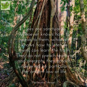
Inspiring quotes

No comments.